Crossing the Catllaràs from end to end in a day
Some forty-five kilometres of track, a dozen short walks and a range that changes its face at every pass.
This is the crossing the author has been repeating for years from his house in Borredà. You go in at Castell de l'Areny, climb to the meadows of la Clusa, travel along the central part of the range among named rocks, high pastures and mining remains, and come down on the eastern side to Sant Jaume de Frontanyà. Along the way there are two mountain refuges, three churches, a sanctuary and some of the widest viewpoints in the Berguedà pre-Pyrenees.
Most of it is done in a 4x4 and the rest on foot, because several points lie away from the track. With every stop it takes about eight hours: three at the wheel and five visiting. If you are short of time, the first thing to cut is the climb to Falgars.
Driven, walked, measured and photographed by Josep Heras Gomis, who has a house at the masia del Pati in Borredà and explores the Catllaràs every season. The full route, with its 49 points, is published on Wikiloc. The data on the protected area and the heritage come from the Mapa de Patrimoni Cultural of the Diputació de Barcelona and the Inventari del Patrimoni Arquitectònic de Catalunya. Last revised: September 2026.
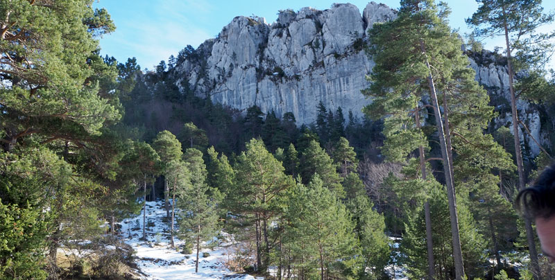
A protected range south of the Cadí
The Catllaràs is a limestone range in the Alt Berguedà, running east to west, south of the Cadí-Moixeró. It has been part of Catalonia's Plan of Areas of Natural Interest since 1992 and is a Special Area of Conservation in the Natura 2000 network. According to the Mapa de Patrimoni Cultural of the Diputació de Barcelona, the protected area covers 5,605 hectares spread across eight municipalities in two counties.
The valleys and streams that cut through it form several ridges, and within a few kilometres you go from Scots pine on the lower slopes to mountain pine higher up and beech woods with box on the shaded sides. More than thirty species of orchid grow here, as does edelweiss, which in Catalonia is found only in this range and in the Val d'Aran and is protected. Red deer are the largest mammals; there are also wildcat, chamois, wild boar, golden eagle and peregrine falcon.
Add to that the human footprint: farmhouses of medieval origin and, above all, coal mining, which from the late nineteenth century filled the range with mine entrances, shafts and cableways. This page focuses on the route through the range; the mines, Gaudí's Xalet and the Falgars sanctuary each have their own page.
Two gateways: Borredà and La Pobla de Lillet
The route in the book runs from south-west to east: it starts in Castell de l'Areny and ends in Sant Jaume de Frontanyà. Castell de l'Areny is reached by a road that leaves the Berga to Ripoll road near Vilada, or from the C-16 via La Nou de Berguedà.
From Borredà both ends are close at hand: Vilada on one side and Sant Jaume de Frontanyà on the other. If you are staying in Borredà, you can do the crossing in either direction and drive home by road.
From La Pobla de Lillet you enter from the north. Beside the monastery of Santa Maria de Lillet a track heads west; after about 4 km there is a junction and the left-hand branch leads straight to the Xalet del Catllaràs, right on the northern stretch of this route. The other way in is the Falgars road. Either way you reach the area of the Roca de la Lluna and the Moreneta, and from there you can carry on to the centre of the range or drop down towards Frontanyà.
Track conditions: it is usually in good condition, but depending on the season it may be wet and some stretches become difficult for a car not prepared for the mountains. The points that can only be reached on foot have their access explained in their own section.
The 24 points, in route order
| Point | What it is | Access | Coordinates |
|---|---|---|---|
| Castell de l'Areny | Starting village | Road | 42.173864, 1.946108 |
| Pas de l'Escalell | Gorge for descending with ropes | Car, on foot for the descent | 42.177474, 1.929446 |
| Barbecue area | Meadow with tables, spring and barbecue | Car | 42.178754, 1.926600 |
| Sant Romà de la Clusa | Romanesque church and refuge | Car | 42.187060, 1.935245 |
| Mirador de la Clusa | Viewpoint with a glass floor | Car | 42.185494, 1.933118 |
| Roc de la Clusa | Rocky summit | 2 minutes on foot | 42.201860, 1.927713 |
| Roc de Catllaràs | High meadow with a large rock | Car | 42.204062, 1.940947 |
| El Pedró | Summit with a survey pillar | On foot | 42.203637, 1.949078 |
| Fundació Miranda | Free-roaming horses | On foot, or by car to the house | 42.196684, 1.946393 |
| Roca del Siló | Vertical rock beside the track | Car | 42.206796, 1.946691 |
| Roca del Coll de la Ceba | Sword-shaped needle | Car | 42.208711, 1.949980 |
| Roca del Cortal | Rock needle | Seen from the pass | 42.208291, 1.952087 |
| Font Assedegosa | Spring | A few metres on foot | 42.209684, 1.953914 |
| Prat Gespador | Meadow for parking | Car | 42.212139, 1.955286 |
| Joc de la Pilota | The miners' meadow | On foot | 42.214071, 1.963365 |
| Roca de la Moreneta | Summit with a cross and a Virgin | On foot, with metal staples | 42.215101, 1.963705 |
| Roques d'Arderiu | Rocky summits | On foot | 42.214451, 1.961611 |
| Roca de la Lluna | The range's great viewpoint | 100 m on foot | 42.222454, 1.964591 |
| Refugi d'Ardericó | Refuge in an old farmhouse | Car | 42.207972, 1.965819 |
| Roca Forcada | Pitchfork-shaped rock | On foot | 42.214673, 1.976129 |
| Sant Julià de Cosp | Romanesque church, almost in ruins | Car | 42.185330, 1.984484 |
| Santuari dels Oms | Marian sanctuary | Car | 42.181604, 2.011260 |
| Mirador de Frontanyà | View of the village | Car | 42.185505, 2.017866 |
| Sant Jaume de Frontanyà | Village and Romanesque church | Road | 42.187449, 2.023248 |
The points are grouped into five stretches, from Castell de l'Areny to Sant Jaume de Frontanyà. Most lie within the municipalities of Castell de l'Areny and La Pobla de Lillet; Sant Julià de Cosp belongs to Les Llosses (Ripollès) and the end of the route to Sant Jaume de Frontanyà.
Stretch 1 · Castell de l'Areny and la Clusa
From the village to the meadows of la Clusa: a gorge, a picnic area, a Romanesque church with a refuge and a viewpoint with a glass floor.
Castell de l'Areny
A small, mountainous municipality of about 24 km², stretching from the summit of Puig Lluent, high up in the Catllaràs; to the south-east, a section of the Vilada stream marks its boundary.
It is first mentioned in the consecration act of the cathedral of La Seu d'Urgell, as castro Adalasindo, a name that over the centuries became Castell d'Alarèn and, through a misreading, today's Castell de l'Areny. The name points to a castle, but no remains are known that would allow it to be located. It was the seat of one of the bailiwicks of the barony of la Portella, and the municipality includes the old parish of Sant Romà de la Clusa, which is the next stop.
Getting there: heading down from the village towards Vilada on the main road, after about 1 km the mountain track leaves from a bend with a very wide entrance (42.168510, 1.937223). It is signposted "Mirador de St. Romà de la Clusa"; the sign gives 5.2 km to the viewpoint.
Coordinates: 42.173864, 1.946108 · 959 m above sea level · open in map
Barranc del Pas de l'Escalell and the barbecue area
Climbing towards la Clusa, on the right, lies the Pas de l'Escalell gorge, listed as an area of natural interest on Castell de l'Areny's heritage map. It is set up for canyoning with the right equipment: it has abseils of up to 20 metres and takes about half an hour to descend. The author recommends doing it after rain, when the stream is running full. If you are not going down, there is a magnificent view of the southern part of the municipality from the top.
Right at the head of the gorge there is a large meadow with grazing cows, a farmhouse and a picnic area with several tables, a spring and a barbecue. It is a good place to spend the day in mushroom season, and for that very reason it is well known: you will probably not be alone. Before lighting anything, check the fire restrictions in force.
Getting there: there is plenty of room to leave the car in the clearing of the barbecue area itself, at the top of the gorge.
Coordinates: Pas de l'Escalell 42.177474, 1.929446 · 1140 m · map — Barbecue area 42.178754, 1.926600 · 1178 m · map


Sant Romà de la Clusa
This is the first major stop on the route and one of those the author considers unmissable. On a shelf of meadows above 1,300 metres stand the Romanesque church, the houses of the old hamlet and a mountain refuge with hot water, showers and hot meals, where you can sleep if you book ahead.
The church dates from the twelfth century and is very well preserved. According to the Mapa de Patrimoni Cultural, it has a single nave with a semicircular apse to the east, a slightly pointed barrel vault and walls of small, irregular stones laid in courses. It has a bell gable with two openings, a double-arched doorway and a raised wooden choir inside. It was restored in 1963-1965 and in 1976; a Romanesque wooden carving and the Baroque altar were lost during the Civil War.
Sant Romà was a parish in its own right within the municipality, and the church is already mentioned in the consecration act of the cathedral of La Seu d'Urgell.
Getting there: follow the track from the barbecue area; you can drive right up to the hamlet.
Coordinates: 42.187060, 1.935245 · 1363 m above sea level · open in map
Mirador de Sant Romà de la Clusa
A superb viewpoint over the southern side of the Catllaràs, with a view that reaches Montserrat on clear days. It has one unusual feature: part of the floor is glass, and because the platform hangs over the cliff you can see straight down to the bottom of the drop. The author half-jokingly compares it to the Grand Canyon.
There is also a small picnic area with two or three tables, and panels identifying the mountains in view.
Getting there: a few metres from Sant Romà, following the signs for the viewpoint.
Coordinates: 42.185494, 1.933118 · 1394 m above sea level · open in map


Roc de la Clusa
A large rocky area on top of one of the highest hills in the Catllaràs, on the boundary between Castell de l'Areny and La Nou de Berguedà. From here you begin to see the northern face of the range, with the Cadí and the Pedraforca to the right.
The drawback is that trees block much of the view and there is no proper viewpoint. Further on there are better places to look north, but this is a good first glimpse.
Getting there: when you reach the top of the track by car, on the left of the path you will see a small house-shaped nativity box nailed to a tree and a signpost. From there walk up along the northern edge of the cliff; the rock is about 2 minutes away.
Coordinates: 42.201860, 1.927713 · 1728 m above sea level · open in map
Detour: the Falgars sanctuary
After the Roc de la Clusa, the route in the book climbs north to Falgars, the Marian sanctuary of La Pobla de Lillet, which overlooks the La Pobla valley and has a hostel, two viewpoints (Joan Casanova and Pedraforca) and the cave where, according to tradition, the image was found. It is the most time-consuming stretch, and where the route crosses itself you can skip it and head straight for the Roc de Catllaràs. Everything you need to know about Falgars is on its own page: the Falgars sanctuary and its viewpoints.
Stretch 2 · The heart of the range
The high, central part of the range, where it is worth leaving the car and walking for a while.
Roc de Catllaràs
A splendid alpine meadow with a large rock in the middle, in the central and highest part of the range. It is probably the best-known spot in the Catllaràs and a must: blocks of rock among pines and short grass where livestock graze.
It is the natural place for a long break. The next two visits start from here on foot, as neither can be reached by car: the climb to El Pedró and the horse pastures further south-east.
Getting there: along the main track, following the route from the Roc de la Clusa (or coming down from Falgars if you took the detour). Park beside the meadow.
Coordinates: 42.204062, 1.940947 · 1670 m above sea level · open in map


El Pedró
One of the highest points in the range, at around 1,765 metres. Some guides call it Pedró de Puiglluent or Pedró del Pla de l'Orri, and it is where the Puiglluent, Catllaràs and Serrat Negre ridges meet. There is a survey pillar on top.
The views are good but, as at the Roc de la Clusa, trees hide part of the horizon and there is no viewpoint. What you do see clearly is the great meadow of the Fundació Miranda just below.
Getting there: on foot from the Roc de Catllaràs; El Pedró lies to the east of the meadow.
Coordinates: 42.203637, 1.949078 · 1759 m above sea level · open in map
Fundació Miranda: free-roaming horses
Another stop the author singles out. The Fundació Miranda rescues horses that have been mistreated or abandoned, and at Pla de l'Orri, in the municipality of Castell de l'Areny, the animals roam freely over wide expanses of meadow. Coming down from El Pedró you see a great green meadow with the horses grazing: one of the loveliest sights of the whole route.
At the foundation's house you can ask about sponsoring a horse and about the activities they run. The horses spend the grazing season here; in winter, when there is no grass, the foundation moves them to lower ground following traditional transhumance, so they are usually seen between spring and autumn. More information on the Fundació Miranda website.
Getting there: from the Roc de Catllaràs, keeping the rock on your left, you can drive to the house, but only if you are taking part in an activity. To see the meadows and the horses it is better to walk, so as not to stress the animals.
Coordinates: 42.196684, 1.946393 · 1610 m above sea level · open in map

Stretch 3 · The ridge of rocks
Rock needles you can see from the car, two springs and a meadow for parking.
Roca del Siló, Roca del Coll de la Ceba and Roca del Cortal
The Roca del Siló is an imposing vertical rock that you can admire without leaving the car: the track passes just above it and then skirts round below, so you see it from above and from below. Perfect for anyone who does not feel like walking.
A little further on, on the right, is the Roca del Coll de la Ceba, a sharp, sword-shaped needle at the top of the pass of the same name. A path runs down from the pass to the Camp de l'Ermità junction, towards Falgars. Several mine entrances are lined up in the vertical wall of the gully below the pass; we cover them on the Catllaràs mines page.
Just behind it is the Roca del Cortal, another needle. Looking south-east from the junction at the top of the pass, the two highest points you see are these two rocks.
Getting there: all three can be seen from the main track; no walking needed.
Coordinates: Siló 42.206796, 1.946691 · 1635 m · map — Coll de la Ceba 42.208711, 1.949980 · 1625 m · map — Cortal 42.208291, 1.952087 · 1612 m · map


Font Assedegosa and Prat Gespador
The Font Assedegosa is a few metres off the track, on the right. It is a good place to freshen up before leaving the car in the meadow next to it.
That meadow is the Prat Gespador, the best place to park on this stretch because several visits start here on foot. Uphill, to the left of the track, the remains of the Catllaràs mining area begin; to the right rises the Roca de la Moreneta. In front of the meadow, beside the track, there is another spring.
Getting there: along the main track; the Prat Gespador is right next to the spring.
Coordinates: Font Assedegosa 42.209684, 1.953914 · 1557 m · map — Prat Gespador 42.212139, 1.955286 · 1532 m · map
Stretch 4 · La Moreneta and the Roca de la Lluna
The stretch with the most summits and the best viewpoint in the range, right in the mining area.

El Joc de la Pilota
A meadow just behind the Roca de la Moreneta. The name, meaning "the ball game", comes from the mine workers, who used to come here to play ball in their free time. Today it is the usual starting point for climbing the rock.
Part of the forest was felled recently, leaving a large clearing like a hole among the pines.
Getting there: from the Prat Gespador, follow one of the PR waymarks that start beside the track, which goes downhill and passes behind the Moreneta.
Coordinates: 42.214071, 1.963365 · 1558 m above sea level · open in map
Roca de la Moreneta or del Joc
It is also called Roca de la Mare de Déu, Roca del Joc or Roca de la Devesa Jussana, and it is on the list of one hundred summits of the Federació d'Entitats Excursionistes de Catalunya. It is well worth climbing: at the top there is a cross, an image of the Virgin and spectacular views.
The climb is short but ends with a small scramble helped by two metal staples. With young children, or when the rock is wet, take care.
Getting there: from the Joc de la Pilota meadow, head straight for the rock until you find the path up, almost at the end of the meadow, right below the highest rock.
Coordinates: 42.215101, 1.963705 · 1602 m above sea level · open in map


Roques d'Arderiu
A lower extension of the Roca de la Moreneta. Once you are on top of one it is easy to cross to the other, and from the Roques d'Arderiu you look straight back at the ridge you have just climbed.
Getting there: from the summit of the Moreneta, following the ridge.
Coordinates: 42.214451, 1.961611 · 1564 m above sea level · open in map
Roca de la Lluna
Probably the main viewpoint in the Catllaràs. The view is 360 degrees, but above all it opens onto the northern face of the range: from here you can clearly see the Pedraforca and the Cadí mountains.
There are two levels. On the first, closest to the track, there is a picnic area with tables. A flight of steps leads up to the main viewpoint at the highest point, with a viewpoint indicator showing which mountains you are looking at.
Getting there: the viewpoint is about 100 metres from the track, at a very well signposted bend. If you are coming from the Xalet, follow the track for about 300 metres to a junction and then straight on for another 300 metres to the sign.
Coordinates: 42.222454, 1.964591 · 1491 m above sea level · open in map

The Catllaràs mines and Gaudí's Xalet
Between the Prat Gespador and the Roca de la Lluna the route crosses the old mining district: mine entrances, shafts, a brick chimney and the remains of the cableways that carried coal down to the railway and the Clot del Moro cement works. There is so much to see that it has its own page: the Catllaràs coal mines, with each entrance, its history and how to get there.
Very close to the Roca de la Lluna stands the Xalet del Catllaràs, the building Antoni Gaudí designed for Eusebi Güell to house the mine engineers. Next to it are a small unstaffed refuge and a spring. We explain it in depth on the Xalet del Catllaràs page.
Stretch 5 · Down to Sant Jaume de Frontanyà
A refuge, two solitary churches and, to finish, one of the smallest villages in Catalonia.

Refugi d'Ardericó and Roca Forcada
Ardericó is an old farmhouse turned into a welcoming mid-mountain refuge, in the municipality of La Pobla de Lillet. When the author visited, it had shared dormitories with mattresses and blankets (bring a sleeping bag), shared bathrooms with hot showers, a communal butane kitchen without utensils and room for horses. The refuge serves meals if you let them know in advance. Information and bookings on the refuge website.
From here you can reach the Roca Forcada, a summit behind the Roca de la Moreneta, lower down. Looking east you see a tall rock shaped like a pitchfork, hence the name. You can walk there from the Joc de la Pilota by the steep path down towards Ardericó and then a small path up to the rock, but if you are driving the author recommends continuing to the refuge and setting off on foot from there, which is much closer.
Getting there: the route's track passes in front of the refuge. According to the refuge itself, the track can be driven in an ordinary car with difficulty and is easier in a 4x4.
Coordinates: Ardericó 42.207972, 1.965819 · 1331 m · map — Roca Forcada 42.214673, 1.976129 · 1530 m · map
Sant Julià de Cosp
A Romanesque church listed in the Inventari del Patrimoni Arquitectònic de Catalunya which, curiously, is not in the Berguedà: the Cosp area is an outlying part of the municipality of Les Llosses (Ripollès) wedged between Sant Jaume de Frontanyà and Castell de l'Areny.
Sadly it is badly neglected, almost in ruins, but it is worth seeing for its exterior and for its completely wild setting. According to the IPAC it has a single nave with a semicircular apse, separated from the nave by two triumphal arches, and a pointed barrel vault. The doorway, with two stepped arches, opens to the south, and on the west front rises a large bell gable with two openings.
Getting there: it is a stop on the route between Ardericó and the Oms sanctuary.
Coordinates: 42.185330, 1.984484 · 1097 m above sea level · open in map


Santuari de la Mare de Déu dels Oms
Now within Sant Jaume de Frontanyà, the sanctuary stands alone on a wide grassy pass, next to a farmhouse. It is protected as a cultural asset of local interest.
According to the Mapa de Patrimoni Cultural, the present building dates from 1785 and was built over a small thirteenth-century Romanesque church when devotion to the Virgin called for a larger one; the first written record is from 1410. It has a single nave with side chapels and a large square presbytery crowned by a lantern, and a square bell tower topped by a pinnacle. The author highlights the sacristy door, a single wooden leaf richly painted in blue, red and gold, which probably belongs to the eighteenth-century enlargement.
Getting there: along the route's track; very shortly afterwards you come out onto the road (42.182503, 2.012406), where the mountain track ends.
Coordinates: 42.181604, 2.011260 · 1120 m above sea level · open in map
Sant Jaume de Frontanyà and its viewpoint
You cannot finish the route without stopping at the village's southern viewpoint: from there you see the houses on top of the hill and, behind them, its majestic church.
Sant Jaume de Frontanyà is one of the smallest municipalities in Catalonia, a mountain district of pine forest and pasture watered by tributaries of the Merlès stream. Its Romanesque church, from the late eleventh century, has been a listed monument since 1931 (today a Cultural Asset of National Interest). It has a Latin-cross plan with a single nave, three apses opening onto the transept and a lantern tower that the Diputació de Barcelona's record describes as unique in Catalonia, all with Lombard blind-arch decoration. It was a house of Augustinian canons regular from 1140 until it was secularised in 1592.
The history of the place goes back further. The first church, Sant Jaume de Frontanyà Vell, was consecrated in the early tenth century, and its consecration act describes a territory reaching Castell de l'Areny, Santa Maria de Lillet and the Cosp ridge: the same Catllaràs you have just crossed. According to the Catalunya Romànica, the act also names Santa Maria de Borredà among its boundaries, one of the earliest records of the village of Borredà. Check the church's visiting hours on the municipality's official website.
Getting there: from where you join the road, head towards Sant Jaume de Frontanyà. The viewpoint is south of the village, before you enter it.
Coordinates: Viewpoint 42.185505, 2.017866 · 1065 m · map — Church 42.187449, 2.023248 · 1072 m · map

How to organise it and where to stay
If you would rather split the crossing, the most logical way is in two parts: the south (Castell de l'Areny, la Clusa, the Roc de Catllaràs and the Fundació Miranda) entering from Vilada, and the north and east (the Moreneta, the Roca de la Lluna, Ardericó and Frontanyà) entering from La Pobla de Lillet or from Sant Jaume de Frontanyà. The range's two refuges, Sant Romà de la Clusa and Ardericó, also let you do it over two days sleeping up high.
Our places to stay are at both gateways to the range, are let whole and take pets at no extra cost.
In La Pobla de Lillet, to enter from the north:
- Tríplex Cadí: 150 m² over three floors, 5 bedrooms, a fireplace and a wood-burning range.
- Catllaràs apartment: for 4 people, with 2 bedrooms.
- Adapted apartment: designed for people with reduced mobility.
In Borredà, to enter via Castell de l'Areny or Frontanyà:
- Masia El Pati: a farmhouse of 1600 with 6 bedrooms, 20 beds, a swimming pool and 1,000 m² of garden.
- Apartment ideal for couples: open-plan, with a large window and a fireplace.
- Charming rural apartment: with air conditioning and a chill-out area.
Frequently asked questions about the Serra del Catllaràs
How long does the full crossing take?
It is about 45 km of track and, with every visit, around eight hours: three driving and five on stops and walks. Skipping the climb to Falgars saves a good deal of time.
Do you need a 4x4?
It is advisable: the track is usually fine, but when wet it gets difficult for an unprepared car. Several points, such as El Pedró or the Roca de la Moreneta, can only be reached on foot.
Can you start from Borredà or from La Pobla de Lillet?
Yes. From Borredà you go in at Castell de l'Areny, via Vilada, or at Sant Jaume de Frontanyà doing the route in reverse. From La Pobla de Lillet you drive up the track that starts beside the monastery of Santa Maria de Lillet towards the Xalet del Catllaràs, or take the Falgars road.
Where can you see the Fundació Miranda horses?
In the meadows of Pla de l'Orri, at the foot of El Pedró, in the municipality of Castell de l'Areny. You get a good view coming down from El Pedró or walking over from the Roc de Catllaràs. In winter the horses are moved to lower ground, so the best time is from spring to autumn.
Which is the best viewpoint in the range?
The Roca de la Lluna, with a 360-degree view and above all of the northern face, with the Pedraforca and the Cadí. The Sant Romà de la Clusa viewpoint, with its glass floor and view as far as Montserrat, and the summit of the Roca de la Moreneta are also well worth it.
Can you sleep in the range?
There are two refuges on the route: Sant Romà de la Clusa, next to the church, and Ardericó, in an old farmhouse in La Pobla de Lillet. It is best to book both. Our apartments in La Pobla de Lillet and Borredà are at the two entrances to the range.